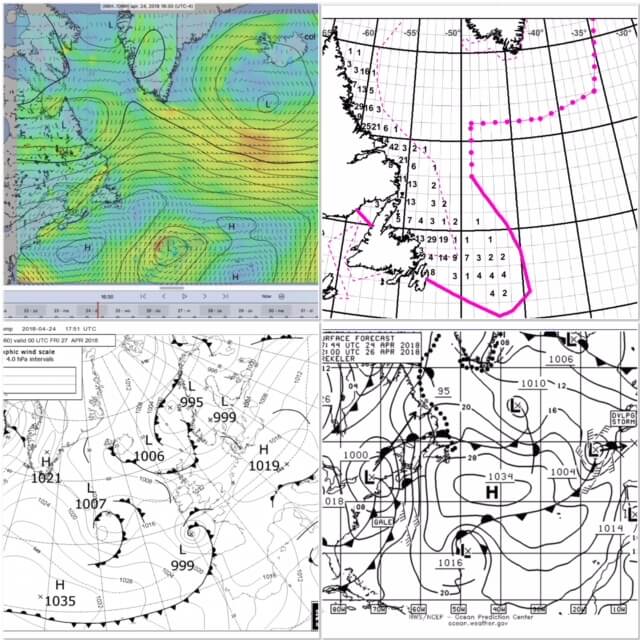
In preparation for my return home from Florida, I have spent the past few weeks studying how to improve weather analysis. We have built up a lot of knowledge over the past few years. The site of Morgan's Cloud has mainly given us new insights on how to analyze weather in a more structured way.
A good tip is to distinguish between strategic and tactical weather analysis. With strategic weather analysis you look 14 days ahead and only on the main lines. With tactical weather analysis you only look 5 days ahead and in much more detail. Both analyses are important for the preparation of multi-day trips (what is a good time to leave?) and during the trips themselves (do we keep course or is it necessary to find a sheltered harbour sooner or change course?). But also during short trips along the coast (what are suitable days for sailing? which harbours/anchorage places are safe and which are not?).
Tactical Weather Analysis
This analysis looks ahead up to 5 days. Longer than 5 days ahead the weather is too unreliable for a smaller specific area.
- Stap 1 is het ophalen van weerkaarten. Langs de oostkust van Amerika halen we de Boston weerkaarten op. Terug in de buurt van Europa gebruiken we de Britse Bracknell kaarten (zoals Henk Huizinga van Zilt Meteo ook doet). Er zijn ook kaarten beschikbaar met informatie over ijsvorming (in Canada en Groenland) en het verloop van orkanen (zodra het orkaanseizoen is gestart). Zie hieronder voor meer informatie om die kaarten op te halen via mail.
- Step 2 is to analyze the weather charts by running through them a few times in chronological order. The aim is to get a feel for weather patterns in a large area and how this is going to change over the next four days. Where are the high and low pressure areas and how do they move? What 'dangerous' weather is developing outside our immediate vicinity? If you do this more often you will learn to recognize patterns.
- Step 3 is to retrieve a gribfile with detailed information of only the small area you are in (max 5 days ahead, 3 hour steps, 0.25 degree accuracy, with wind/rain/pressure/waves and gust). Morgans Cloud tipped LuckGrib as a viewer and it seems to work fine. It is also possible to use ZyGrib or another viewer.
- Step 4 is to analyze the grib file and compare it with the weather charts. Based on this we can answer the questions as mentioned above in the introduction.
- Step 5 is to write down the prediction in steps of 6 hours and four days ahead. We do this in a spreadsheet. This makes it easier to remember and makes it easier to make a comparison with the predictions of the previous days.
- Step 6 is the retrieval of weather information from text files written by meteorologists. For many areas it is possible to retrieve such a text file by mail. This information is also available via radio broadcasts and Navtex. See below for more information on how to retrieve these text files via e-mail. This is deliberately the last step and only for double-checking your own analyses. If all goes well we have already made the right analysis ;-).
Strategic weather analysis
This analysis looks 14 days ahead, the maximum number of days that gribfiles are available. It is not necessary to do this every day as long as the weather is stable. For example, every 2-3 days and more often if the weather is more unstable. It is important not to do this analysis until the tactical weather analysis has been completed.
- Stap 1 is is het ophalen van een gribfile voor een groot gebied (1 graad nauwkeurigheid, stappen van 12 uur, 14 dagen vooruit, met wind/press/rain). Zodat we kunnen zien wat er verder van ons vandaan gebeurt. Deze file zal zo’n 250kB zijn en download via Iridium duurt ongeveer 45 min, maar dat geeft niet want we hebben de tijd en een onbeperkt data-abonnement.
- Stap 2 is het analyseren van de gribfile door er meerdere keren geheel doorheen te lopen. Met als doel de volgende vragen te kunnen beantwoorden. Welke weg volgen de lage druk systemen? Hoe sterk zijn die? Is er een neiging tot snelle intensivering? Zijn er hoge druk systemen? Hoe snel bewegen die? Hoe stabiel is het Azoren hoog en waar ligt die? Doel is het analyseren van patronen en dit niet te gebruiken als tactische weeranalyse.
Retrieval of information by mail
This can be done by sending an email to query@saildocs.com.
The title doesn't have to say anything. Include the following 'Send' lines in the body.
Boston weather charts
These are five maps of about 26kb in size that cover respectively current weather east atlantic, current weather west atlantic, entire atlantic in 24 hours, entire atlantic in 48 hours and entire atlantic in 96 hours.
Send PYAA11.TIF
Send PYAA12.TIF
Send PPAE10.TIF
Send QDTM10.TIF
Send PWAM99.TIF
UK Bracknell weather charts
These are seven tickets of about 20kb for current, 24 hours, 48 hours, 60 hours, 72 hours, 96 hours and 120 hours respectively.
Send PPVA89.TIF
Send PPVE89.TIF
Send PPVI89.TIF
Send PPVJ89.TIF
Send PPVK89.TIF
Send PPVM89.TIF
Send PPVO89.TIF
Tropical cyclone / tropical depression / tropical storm / hurricane
Send PWEK11.TIF (16kb)
Ice chart
Send PIEA88.TIF (271kb)
Bermuda cards
Handy for near Bermuda, the entire south east coast of America and on the way from Bermuda to the Azores. It's four consecutive days. The big traffic jams are 450kB, the small ones (also easy to read) are 50kB.
Send http://www.weather.bm/images/marineChart/Latest/Large/_chartLarge36.jpg
Send http://www.weather.bm/images/marineChart/Latest/Large/_chartLarge60.jpg
Send http://www.weather.bm/images/marineChart/Latest/Large/_chartLarge84.jpg
Send http://www.weather.bm/images/marineChart/Latest/Large/_chartLarge108.jpg
Send http://www.weather.bm/images/marineChart/Latest/Small/_chartSmall36.gif
Send http://www.weather.bm/images/marineChart/Latest/Small/_chartSmall60.gif
Send http://www.weather.bm/images/marineChart/Latest/Small/_chartSmall84.gif
Send http://www.weather.bm/images/marineChart/Latest/Small/_chartSmall108.gif
Satellite image (east coast US)
Send evnt99.jpg (264kb)
Grib file retrieval for tactical analysis
First delineate area with N and W lines.
Resolution is 0.25
Steps from 3 hours to 120 hours
Pick up Wind, Press, Rain, Gust and Waves
Speed of the boat
Direction of the boat
With those last two you get a gribfile that shifts the area according to speed and direction of the boat.
Send gfs:xxN,yyN,zzW,ttW|.25,.25|0.3.6..120|WIND,PRESS,RAIN,GUST,WAVES|WIND|7.0.080
Request Gribfiles for strategic analysis
First delineate area with N and W lines.
Send gfs:xxN,yyN,zzW,ttW|1,1|0,12..336|WIND,PRESS,RAIN
Messages written by meteorologists
Many of these types of messages are available in small text files. If you have the internet address you can send it to saildocs and you will get the written text back in the mail. The names of the text files along the east coast of the USA can be found at the website of NOAA.
Two examples:
Tekstfile voor de gehele Atlantic
Send http://tgftp.nws.noaa.gov/data/forecasts/marine/high_seas/north_atlantic.txt
Text file for a certain area along the US east coast
Send ftp://tgftp.nws.noaa.gov/data/forecasts/marine/offshore/am/amx115.txt