Here is a collection of the experiences we have built up step by step during our sailing trips with our previous boat the Brandaan (2006-2014) and the SeaQuest (2014 - present).
Ankeren
On the Brandaan (HR40) we have always been able to anchor very well with a 24 kg Delta anchor. Rarely the anchor didn't pick up and we had to try again. We didn't stay down twice; the first time during our first year on the Brandaan we anchored in the bowl at the Roompot Lock. Then we woke up by light banging from the keel on the sloping stone side. Without any problems we picked up the anchor and put it down again properly. The second time was on the Suriname river with a strong current during spring tide. We were not on the boat at that time and on our return we found the boat a hundred metres away. Fortunately, no further damage. Afterwards, we should have dropped a second anchor on that tidal river in line with the first anchor, so that at 180 degrees rotation you will be behind the second anchor..On the SeaQuest we anchored the first year with a 32 kg Delta anchor. It soon became clear that this anchor was not sufficiently reliable and that it was too easy to 'scratch' in stronger winds. That cost us a night's rest in a narrow anchor bay in Scotland when the wind blew hard for one night. Now we have a Rocna anchor of 40kg, and so far it has been lying like a house. We have a lot of confidence in it.
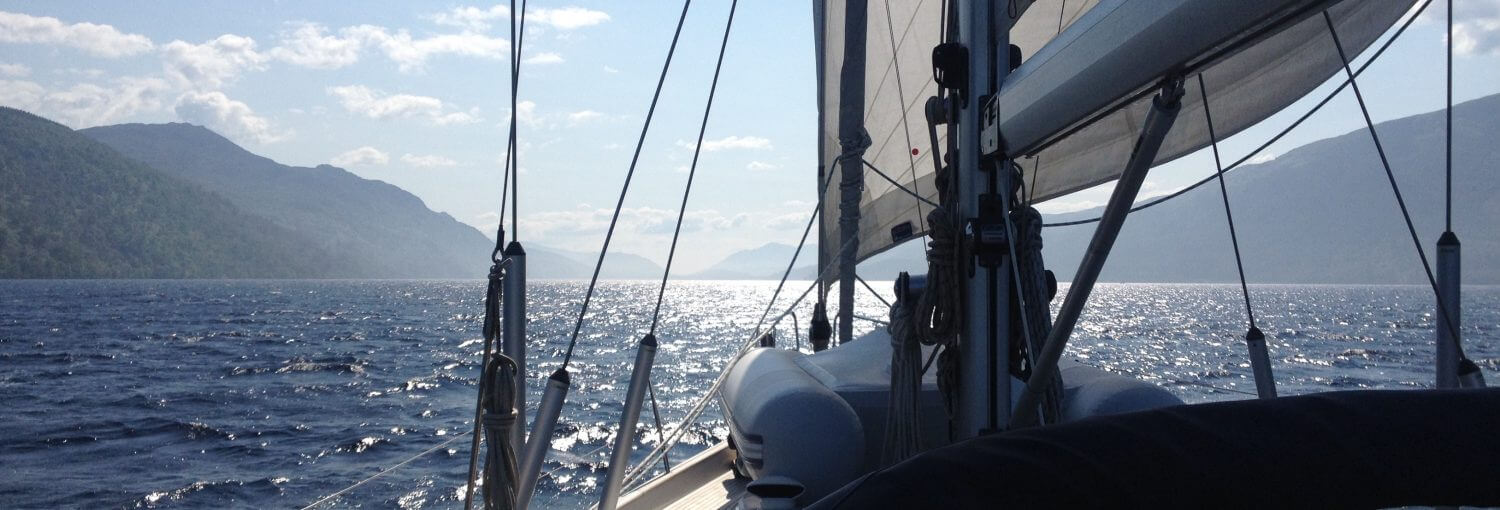
Anchoring is the ultimate way of freedom for us. There is nothing more beautiful than spending the night at a beautiful deserted anchorage in the middle of nature.
We always anchor the same way. That's what's in there. Toine usually finds the anchorage and is behind the wheel. Mira drops anchor at the front. You can tell how much chain has to come out by the coloured plastic anchor marks that we have applied every 5 metres.
Usually you will immediately notice if the anchor picks up properly and you can turn off the engine. When in doubt, we wait for a while and then put the engine in reverse as a test. We always pick up the anchor in the same way. Mira is at the front and picks up the anchor and indicates with arm/hands where the anchor is. Toine is behind the wheel.
Nights at sea
We built it up step by step at night. I remember the first night was exciting, with strange noises and no rest to sleep. The first time we sailed 48 hours in a row with two nights at sea was in 2007 from Vlieland to Norway. I also remember that very well ... biting on a moving boat once in a while and still sailing every moment of the day. That's how it went on for one or two nights during the summer holidays on the North Sea until the start of our Altantic tour in 2009. By the way, the girls slept very well from the start, even in bad weather and with a moving boat. We only really learned how to sail through the night with a waiting rhythm that suits us well during the Altantic round (2009-2010). We also learned that making longer trips is 'life at sea' without being constantly busy with sailing. The boat does the work. We also started to spend some time indoors when there wasn't much to do and see outside. But always with the alarm clock at max 17 minutes and every 17 minutes we have a good look around outside. And of course only in areas where this is justified. During summer holidays on the North Sea we are always outside.
The rhythm that suits us well:
21.00 - 00.00: Toine is waiting and Mira is sleeping; Mira likes to go to bed early.
00.00 - 03.00: Mira waits and Toine sleep; usually not yet the most deep sleep of Toine.
03.00 - 06.00 hrs: Toine is waiting and Mira is sleeping; Mira is tired and usually sleeps fine.
06.00 - 09.00 hrs: Mira waits while it gets light again and Toine sleeps in a deep sleep until often 10.00 hrs or later.
In case of lack of sleep due to bad weather and a moving boat, for example, we often catch up with sleep during the day.
Now that we are used to sailing at night, we do that very easily during the summer holidays in Northern Europe. All four of us always effortlessly pick up the rhythm of the 'life on the boat' we are already sailing and 'continue' one or more nights. As a result, we can handle a wide range of sailing destinations in 3 to 4 weeks of summer holidays.
Weather information
Every sailor knows of course that the right weather information is important for a successful sailing trip. As soon as you go out to sea for multi-day trips, this becomes more and more important. In the years leading up to our Atlantic round trip, we mainly obtained weather information from gribfiles and weather forecasts by agencies such as the BBC shippingforcast. As part of the preparation for our Atlantic tour, we followed a weather course at Zilt Meteo by Henk Huizinga. A very valuable course in which we learned in two days to interpret handmade weather charts, such as the English Bracknell charts. And these are always better for sea trips than the computer generated maps and gribfiles. I still regularly listen to Henk's weekend weather report on Thursdays. That keeps you practicing reading weather charts.
During our Atlantic tour and also now during longer trips at sea, we always use those Bracknell maps as our first source (and in other parts of the ocean of maps that apply to that area). As second source near England also the shipping forcast of the BBC with predictions for the next 48 hours. For a trip along the English coast, the forcast for inshore waters works well. As a third source we use gribfiles and surveys such as windfinder or windguru. During the longer sailing trips out of reach of the internet, we listen to the VHF messages that are broadcast regularly and read the messages on the Navtex.
During our Atlantic tour we got the weather maps and gribfiles with the SSB radio. And sometimes with the Iridium satellite phone. On the SeaQuest the SSB radio was installed last winter, but we will only use it again on future longer sailing trips.
Navtex is on the SeaQuest and is also very handy. Gives the same information as radio messages, but can be read at any time if you like. Just like SSB an 'old-fashioned' system that still seems to work very well.
We sometimes supplement the combination of the three sources with weather information from local information, for example from a harbour master. In this way we make sure that we are always well prepared to go out on the road. Our experience is that the BBC shipping forcast is a bit on the cautious side, and the gribfiles often have a beaufort underneath. Also prepared it sometimes happens that we are surprised and that is often due to a local weather effect (extra wind around capes) that we didn't know enough about.
In the spring of 2018 I looked into improving weather analysis and that led to the following message: Structured weather analysis.
Really indispensable on longer trips
That's with a dot at the top of the SSB radio. Not only to retrieve weather information but also for social contacts on the road. If you're on the road for a longer period of time, you'll meet other sailors and you can easily join small or bigger 'cruiser-nets'. Very important for safety and social contacts on the road. The SeaQuest now also has an SSB radio. Not really indispensable, but very valuable, is a water maker. Just like diesel, it is essential to have enough water on board. You are much more independent of stops with a water maker. We certainly experienced that during our tour of the Atlantic. But also during the summer holidays to the Scilly islands it was wonderful to have a water maker on board. That means that you also have to be a little less frugal and you can take showers more often, for example. Even though we're always a bit frugal with water. Remember to bring spare membranes with you. Once we accidentally made water while refuelling with diesel in the water. Well, then the membranes are broken and the water tastes brackish in no time.
Satellite telephony and internet connection
Saillining
What is less useful with a fixed cutter is sailing short cruising wrecks with light wind. We can't just tack without bringing in a large part of the genoa. A fixed cutter is an advantage at sea to be able to set the cutter quickly when the wind is stronger. But a disadvantage on smaller waters like crosses on the Grevelingermeer.
Navigate
For navigation we use a Raymarine E120 plotter. It is located outside in the cockpit on top of the plateau under the hood. A logical place where the plotter is easy to see while sailing and can also be used when the weather is bad. Down at the chart table we have a second screen and also there the plotter can be fully used. We do everything with this screen. Viewing the map, plotting routes, watching the tides and following a route via waypoints (with the automatic pilot switched on the track). We also see the AIS information (and now also the AToN signals with the new RayMarine 650 AIS receiver) and information given by the radar. What if the plotter suddenly doesn't work anymore? What is the backup then? The first backup is the A67 plotter on the steering position. This can be the same as the main plotter, but has a smaller screen and is in a slightly less convenient place. The second backup is the iPad with its own GPS and Navionics maps. We have now purchased iNavx so we can use the Navionics maps with AIS information on the iPad as well, but we have no experience with that yet. For us the iPad remains the backup. An iPad is easy to use in the harbor and indoors without the weather influences of sun and water. But in more extreme circumstances we prefer the Raymarine plotter.
Other backups for GPS position are the Iridium GO and the VHF; both have their own GSP receiver. In combination with paper maps in distress also good to use.
So far we have no experience with routing software, but we are fully engrossed in qtVLM. We think that's something to use for the longer trips in the coming year. That program is free and can combine weather (gribfiles) and flow information with the route to be sailed and with input from the polar diagram of our boat to calculate an optimal route.